Kashgar Location Map: Where is Kashgar on Map
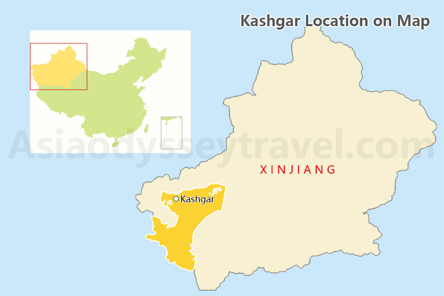
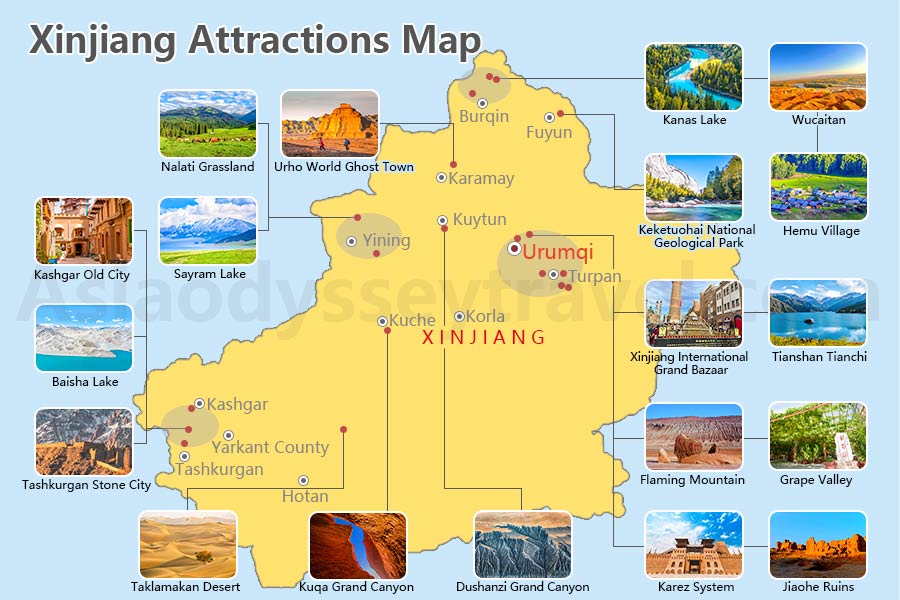
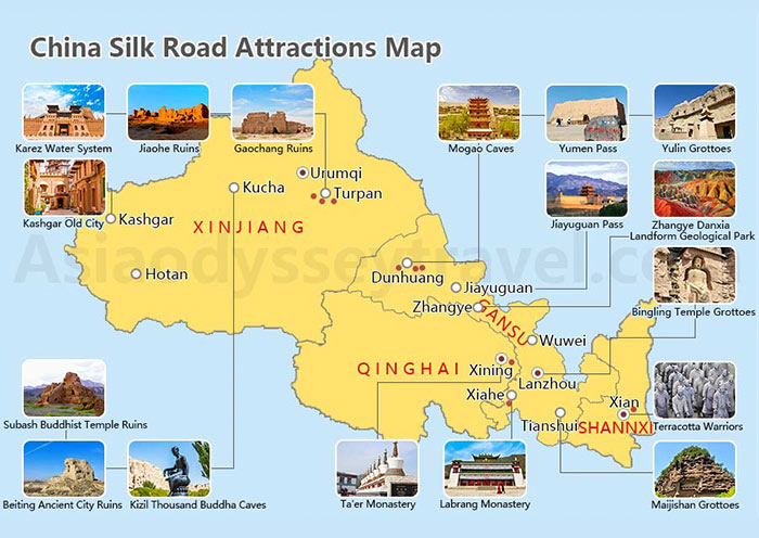
Kashgar, also spelled Kashi, is a historic area located in the westernmost part of China in the Xinjiang Uyghur Autonomous Region. It is situated at the western end of China Silk Road and serves as a gateway to Central Asia. Kashgar is close to the borders with Tajikistan, Kyrgyzstan, and Pakistan. Known for its rich cultural heritage, unique architecture, and vibrant markets, Kashgar holds a significant place in both Chinese and Central Asian history.
Kashgar City Map:
Kashgar City is located in the northern edge of larger Kashgar Area.
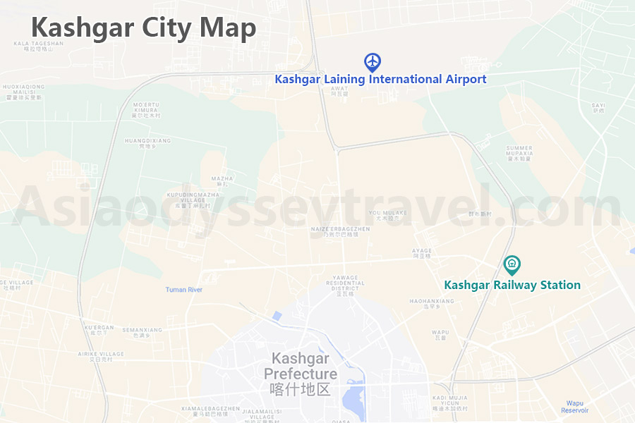
- Kashgar Laining International Airport (KHG): Connects Kashgar with major Chinese cities such as Chengdu, Xi'an, Lanzhou, and Xining, as well as other regions within Xinjiang. It also has international connections to cities like Almaty.
- Kashgar Railway Station: Being the westernmost railway station in China, it's the sole railway station in Kashgar city. Currently, it has a single regular train line. To the east, it connects to Aksu, Kuqa, Korla, and Urumqi in Xinjiang. To the southeast, it connects to Shache, Hotan, and Ruoqiang.
Kashgar Tourist Map: Top Attractions in Kashgar City and Tashkurgan County
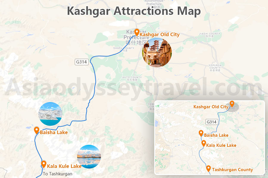
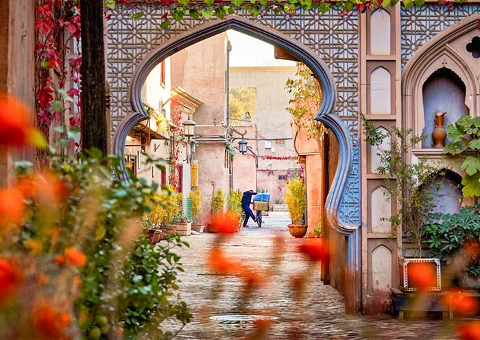
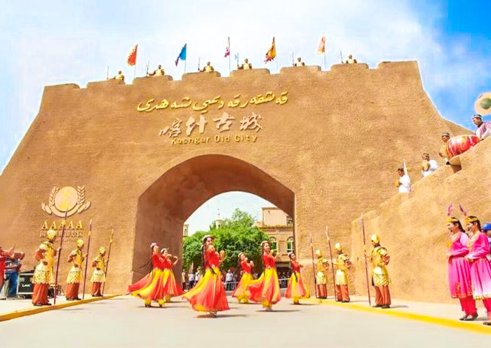
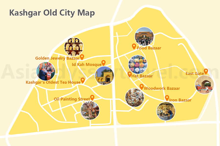
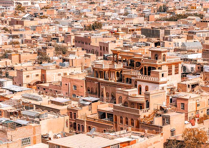
Kashgar Old City host many attractions in Kashgar City. Kashgar Old City is historic city with a maze of narrow alleys, traditional mud-brick houses, and bustling markets. Experience the vibrant local culture and witness the city's ancient charm. Here is the Kashgar Old City Map.
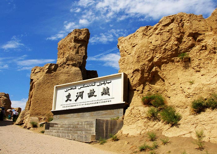
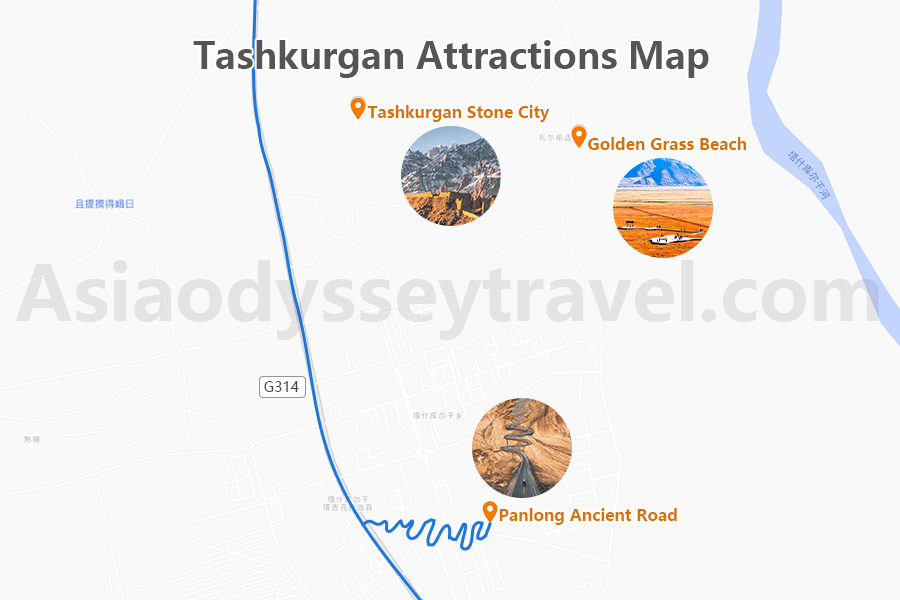
Tashkurgan County is another popular tourist destination in Kashgar Region. Tashkurgan County borders Pakistan, Tajikistan, and Afghanistan, making it a strategically important region with a rich cultural heritage. Explore the ancient Tashkurgan Stone City, a historical fortress that dates back to the Han Dynasty, offering insights into the region's past.
Kashgar Transportation Map
Kashgar to Tashkurgan Map
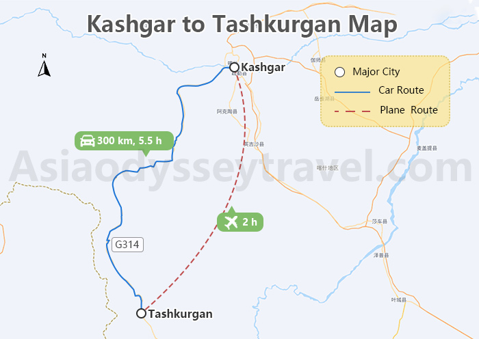
Tashkurgan is 300 kilometers away from Kashgar by road, taking approximately 5.5 hours by car. Along the way, you will pass through the Pamir Plateau, the China-Pakistan Friendship Highway, and more. Additionally, there are direct flight routes connecting Tashkurgan with Kashgar city.
Kashgar to Urumqi Map
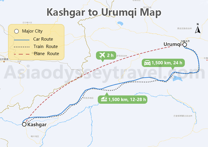
The distance between Kashgar and Urumqi is approximately 1,500 kilometers by road. The journey typically takes around 24 hours by long-distance bus or car, passing through diverse landscapes such as the Taklamakan Desert. Alternatively, travelers can opt for a direct flight which takes about 2 hours to reach Urumqi from Kashgar. This route offers a quick and convenient way to travel between these two significant cities in Xinjiang. You can also take a regular long-distance train from Kashgar to Urumqi, whick takes about 12-28 hours.
Kashgar Travel Map: How to Plan a Kashgar to Tashkurgan Tour
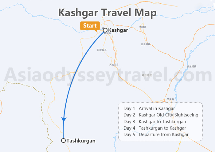
Day 1: Arrival in Kashgar City.
Day 2: Explore Kashgar Old City, including visits to the iconic Id Kah Mosque and an ancient tea house.
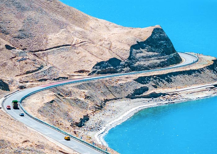
Day 3: Travel along the China-Pakistan Highway to Tashkurgan, experiencing the stunning Pamir Plateau, Baisha Lake, Karakul Lake, and a visit to a Tajik family.
Day 4: Return to Kashgar via the China-Pakistan Highway, exploring the historic Tashkurgan Fort (Stone City) and the picturesque Alaer Golden Grasslands.
Day 5: Depart from Kashgar after a memorable journey through the cultural and natural wonders of Xinjiang.
Travel with Asia Odyssey Travel (AOT) to Explore Kashgar, Xinjiang
Embark on an unforgettable journey to Kashgar, Xinjiang with Asia Odyssey Travel (AOT), where the rich tapestry of Central Asian culture and history unfolds. AOT, with its deep expertise in regional tours, offers personalized travel packages that allow you to experience the very essence of this vibrant city at the heart of the Silk Road.
Tour Packages: Urumqi Tours, Kashgar Tours, Tashkurgan Tours, Xinjiang Tours, Xinjiang Silk Road Tours
Kashgar Travel Guide: Kashgar Old City, Kashgar Attractions, Kashgar Map
Kashgar Transportation: Chengdu to Kashgar, Xi’an to Kashgar, Urumqi to Kashgar, Kashgar to Tashkurgan
Silk Road Travel: Silk Road Travel Guide, Silk Road Cities, Silk Road Trip Planning Guide, Silk Road Itinerary, Silk Road Attractions, Silk Road Map, Silk Road Facts
