Runny was our travel consultant for a group of 10 people. Runny was professional and very prompt in answering our queries and concerns about the trip. The tour guides provided could speak English which is a plus point for us. The hotels provided were great as the rooms were big and clean. Food was great as we tried the local food and the portions were very generous. One point to note for improvement was that the train ride from Dunhuang to Turpan was at 5pm and hence we arrived very late in Turpan. Flying into Kashgar was also quite late and we were all very tired. However, inspite of this, everyone said that they really enjoyed the trip very much. The sights, food and accommodation were great, so thanks to Runny for a well organised trip. A friend had asked about our trip and I recommended Runny to him.
5 Days Urumqi Turpan Tour: A Glimpse into Xinjiang
- Highlights
- Itinerary
- Price
- Trip Notes
- Accommodation
- Photos
- Reviews
From Xinjiang’s Capital to Turpan's Silk Road Snapshot
The 5 Days Urumqi Turpan Tour is perfectly suited for those with limited time, allowing travelers to quickly yet thoroughly immerse themselves in the essence of Xinjiang. From Urumqi, the bustling capital and gateway city, to Turpan, a crucial Silk Road oasis, you'll explore the essence of Xinjiang's unique heritage and scenic beauty. These destinations are very representative and are also very close to each other, making them easily accessible.
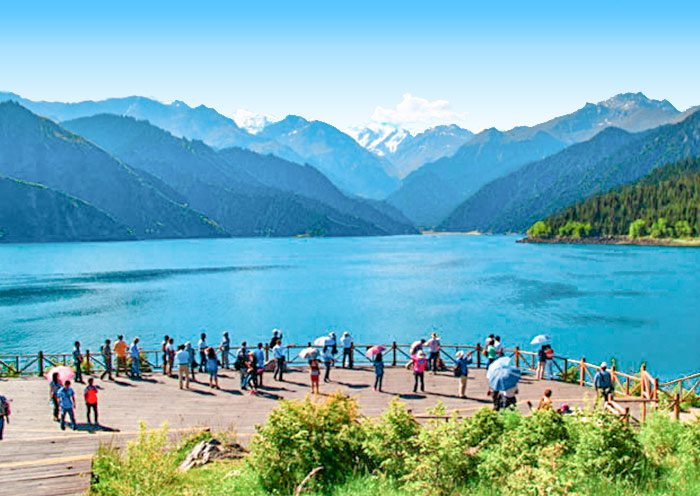
Urumqi, as the regional hub, offers insights into the contemporary lifestyle of Xinjiang's multi-ethnic communities. Heavenly Lake of Tianshan, located on the east side of Urumqi is one of Xinjiang's most renowned tourist destinations. It is an enchanting alpine lake nestled high in the Tianshan Mountains.
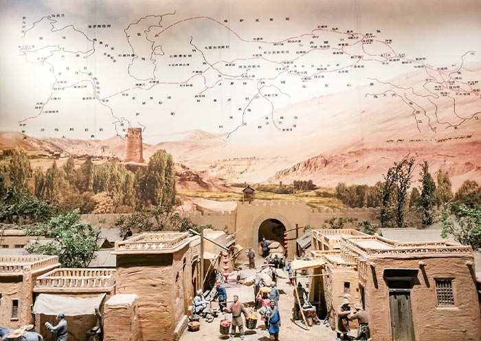
Turpan, situated a mere 3-hour drive northwest of Urumqi, provides a gateway to understanding the Silk Road. This oasis city in eastern Xinjiang was historically a vital stop on the ancient trade route. The Turpan area boasts numerous important historical and archaeological sites, such as the Bezeklik Thousand Buddha Caves, Jiaohe Ancient City Ruins, Karez System, and Emin Minaret. These sites not only testify to Turpan's significance on the Silk Road but also showcase the cultural and religious diversity along this historic route.

Itinerary at a Glance
Urumqi (3 Days)
Xinjiang Regional Museum, Heavenly Lake of Tianshan
Turpan (2 Days)
Flaming Mountains (drive-by), Tuyoq Uyghur Village, Bezeklik Thousand Buddha Caves, Jiaohe Ancient City Ruins, Karez System, Emin Minaret
Itinerary Day by Day
Ni Hao! Welcome to Urumqi, the capital of Xinjiang Uygur Autonomous Region! Upon your arrival at Urumqi airport, your tour guide and driver will greet you at the exit. They'll then escort you directly to the downtown area and assist you with checking in at your hotel.
Note: Xinjiang follows the unified Beijing Time, which is UTC+08:00. However, due to its geographical location within the UTC+6 time zone, the actual local sunrise and sunset in Xinjiang occur about two hours later than they would according to Beijing Time.
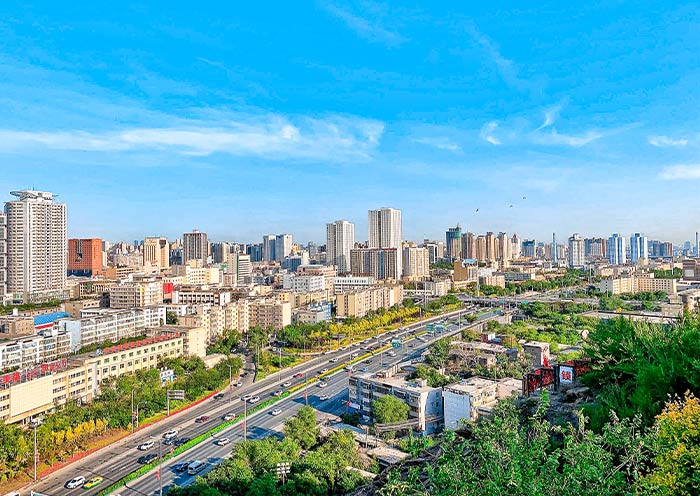
Urumqi (乌鲁木齐), the capital of the Xinjiang Uygur Autonomous Region in China, is notable for being the largest city in the world that is furthest from the ocean, with a distance of over 2,500 kilometers from the nearest coastline. Urumqi is located in northwestern China, adjacent to Central Asian countries, and is often referred to as the "Urban Heart of Asia." Historically, Urumqi played a significant role as a major stop on the ancient Silk Road, facilitating trade between China and the West.
This history has left a lasting impact, making Urumqi a melting pot of ethnic groups, including Uyghurs, Han, Kazakhs, and others, which has shaped the unique cultural ambiance of western China. In addition to its rich history, the city is surrounded by the rugged beauty of the Tian Shan mountains, providing stunning backdrops and opportunities for outdoor activities.
Arrival Ideas: Urumqi Diwopu International Airport (IATA: URC) serves as the main airport for Urumqi, the capital of Xinjiang Uygur Autonomous Region in China. Urumqi Diwopu International Airport offers flights to many major cities across China like Beijing (about 4 hours), Xi’an (about 3.5 hours), Shanghai (about 5.5 hours), Guangzhou (about 5 hours), Shenzhen (about 5.5hours), Chengdu (about 3.5 hours), Chongqing (about 4 hours), Lanzhou (about 2.5 hours), Kunming (about 4.5 hours), Zhengzhou (about 5 hours), etc. It also serves as an important air hub for routes to Central Asia, with connections to cities such as Islamabad, Almaty, Astana (now Nur-Sultan), Dushanbe, Istanbul, and Tehran.
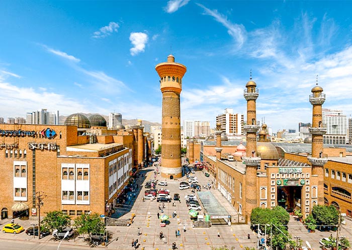
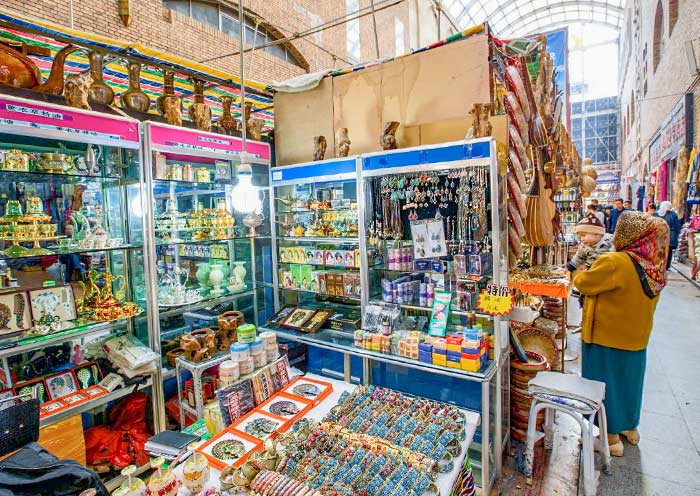
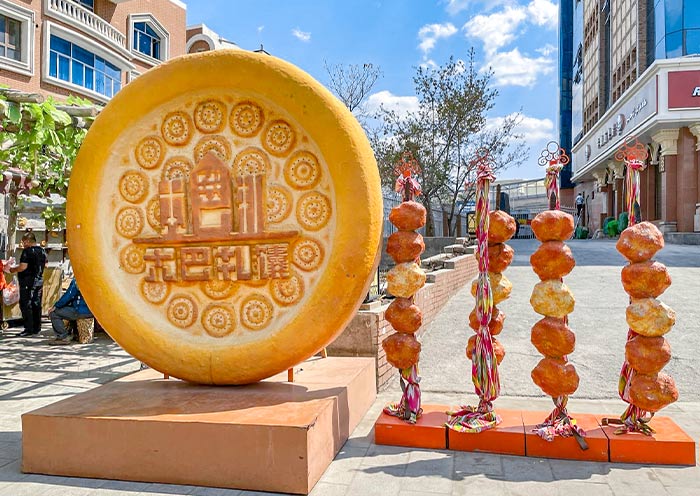
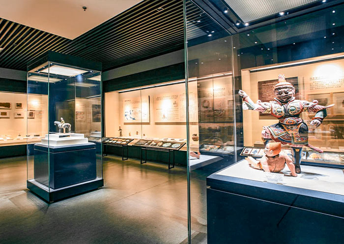
Today, you'll embark on a full-day exploration, from the breathtaking natural beauty of Tianshan Tianchi Lake to the enlightening exhibits at the Xinjiang Regional Museum.
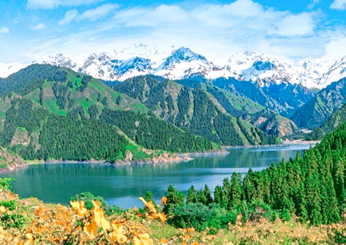
In the morning, you'll be driven approximately 70 kilometers (about 1-1.5 hours) to Heavenly Lake of Tianshan (天山天池), a UNESCO World Heritage Site. Nestled at an elevation of around 1,980 meters (6,500 feet) above sea level, this serene alpine lake is surrounded by lush forests, snow-capped peaks, and breathtaking landscapes. Renowned for its crystal-clear waters, panoramic Bogda mountain views, and connections to ancient myths and legends, Heavenly Lake is a must-see. One such legend involves the Queen Mother of the West (Xi Wangmu), who is said to have hosted a banquet for the Eight Immortals here.
Upon arrival, you'll first take 40-minute sightseeing bus ride through the dramatic mountains. Then, enjoy 10-minute walk to the picturesque lake. Enjoy a leisurely stroll around Heavenly Lake, taking in the fresh mountain air and diverse flora and fauna.
Optional Activities (additional fee required):
- Boat Ride: Cruise across the peaceful waters of the lake, immersing yourself in its beauty and the reflections of the snow-capped mountains.
- Cableway Ride: Take a cableway up to Mayashan for even more stunning views of Bogda Mountain.
After lunch, return to Urumqi and visit the Xinjiang Regional Museum (新疆维吾尔自治区博物馆). This renowned museum showcases theregion's rich history, ethnic cultures, and the ancient Silk Road. Explore extensive collections that include exoticartifacts from the Silk Road, and fascinating displays of traditional ethnic costumes and household items from variouscultures such as Uyghur, Kazakh, and Han. The most unique is the exhibit of ancient mummies, which houses some of theworld’s best-preserved mummies, including the famous “Loulan Beauty 楼兰美女”, one of the 3,800-year-old desert-mummifiedbodies of Indo-European ancestry. Remember to take a look at the 'Five Stars Rise in the East, Benefit China' HanDynasty Brocade Armband (”五星出东方利中国”汉代锦护臂), which is one of the first batches of cultural relics in China that wereprohibited from being exhibited abroad. It is acclaimed as one of the greatest archaeological discoveries of20th-century China. Also, the "Fu Xi and Nu Wa Silk Painting (伏羲女娲图)" illustrates the image of human ancestors fromancient Chinese myths and legends, dating back to the Tang Dynasty. The museum’s immersive exhibits will transport youback in time, allowing you to learn about the fascinating history of the Silk Road and the cultural interactions thathave shaped Xinjiang.
Note: If the Xinjiang Regional Museum is closed on Monday, we will visit the Urumqi Grand Bazaar (新疆国际大巴扎) instead.
After the tour, return to your hotel in Urumqi.
Free Time Ideas:
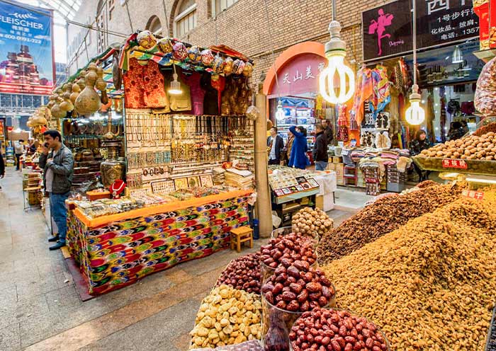
The Urumqi Grand Bazaar, also known as the Xinjiang International Grand Bazaar, is a vibrant marketplace and a perfect way to spend your free time. Explore the many shops and stalls offering various local products, including traditional Uyghur clothing, carpets, handmade crafts, silk scarves, jewelry, spices, and dried fruits. Be sure to try local favorites such as lamb kebabs, polu (pilaf), naan bread, and laghman (hand-pulled noodles). Additionally, the architecture of the Grand Bazaar itself is worth admiring with its grand minarets, domes, and intricate Islamic-inspired designs.


After breakfast, embark on a scenic 3-hour drive (180 km) from Urumqi to Turpan. Along the way, you’ll pass the striking Salt Lake and the impressive wind power station, the largest in Asia, at the foot of the Tianshan Mountains.
Turpan (吐鲁番) is located in the eastern part of Xinjiang. Situated in the Turpan Depression at 154 m below sea level, it's the second-lowest depression in the world and the hottest spot in China, earning it the nickname "Fire Land."
Despite its arid climate, the ingenious Karez irrigation system has transformed this desert region into a fertile oasis, renowned for its agriculture, especially grape production. As a crucial stop on the ancient Silk Road, Turpan served as a hub for trade and cultural exchange between East and West. The area is dotted with historical sites - ancient city ruins, remnants of fortifications, and Buddhist cave complexes - testifying to its rich cultural roots.
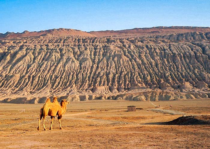
Upon arrival in Turpan, you will drive to Tuyoq Valley along the Flaming Mountain Grand Canyon. The Flaming Mountains (Huoyan Shan), named for their intense heat and reddish-brown sandstone that appears to glow like fire under the desert sun, are one of Turpan’s most iconic landscapes. Stretching over 100 kilometers from east to west, these eroded hills create a striking, otherworldly view. Along the way, we can stop for photos.
Cultural Background of Flaming Mountains
The Flaming Mountains are steeped in legend, depicted in the famous Chinese literary classic Journey to the West by Wu Cheng’en. In the story, the Flaming Mountains block the westward journey of Tang Sanzang and his companions, as the mountain is ablaze with scorching heat. To overcome this obstacle, the Monkey King, Wukong seeks out Princess Iron Fan and borrows her Banana Leaf Fan, which he uses to extinguish the fire and allow the group to pass safely. The video game Black Myth: Wukong also introduces the Flaming Mountains as one of its game settings, drawing on this legendary scene.
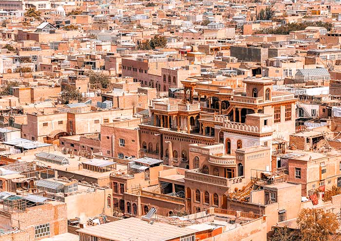
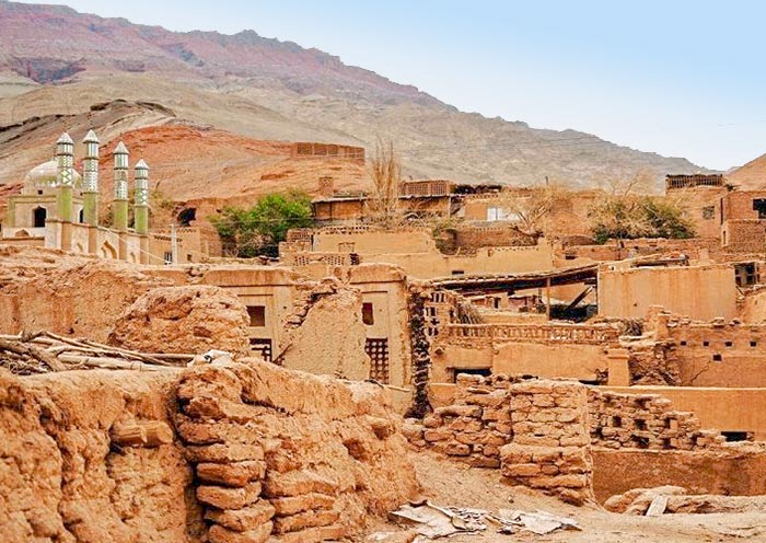
The winding road along the cliffs of the Flaming Mountains will soon lead you to Mazar Village (麻扎村), nestled in the Tuyoq Valley (吐峪沟). It is the oldest surviving Uyghur village, with a history of over 1700 years. The mud-constructed town offers a glimpse of traditional Uighur life and architecture. Here, every household grows mulberry, apricot, or jujube trees around their homes. The doors are adorned with colorful paintings of flowers and fruits, and the window lattices are also decorated with a variety of motifs. The ancestors of Mazar Village, adapting to the local environment and survival needs, ingeniously used locally sourced yellow clay to construct their homes. This has resulted in one of the best-preserved earthen architecture complexes in China today. The earth-toned dwellings adorned with colorful door frames, set against the backdrop of red mountains, are extremely photogenic.
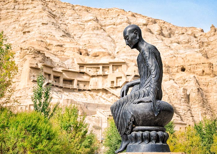
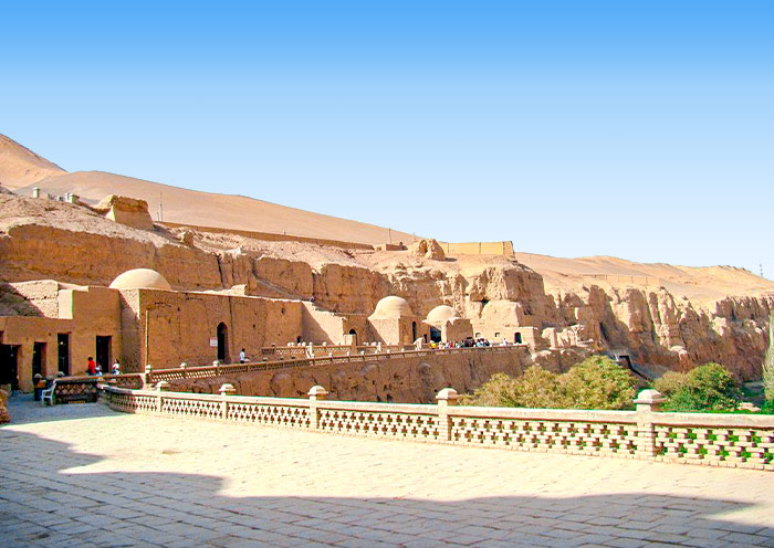
Next, make your way to Bezeklik Thousand Buddha Caves (柏孜克里克千佛洞), which is a complex of Buddhist cave grottos located on the cliffs of the Flaming Mountains. Dating back to the 5th to 14th centuries, the Bezeklik Thousand Buddha Caves - Silk Road World Heritage, once served as one of the most significant and beautiful grottoes on the Silk Road, as well as a royal monastery and temple for the Kingdom of Gaochang, played a significant role in the spread of Buddhism across Central Asia. The name "Bezeklik" means "place of paintings" in the Uyghur language, reflecting the caves' renowned collection of colorful murals.
Here, you'll step into the remnants of this ancient Buddhist site, marveling at an impressive collection of murals and sculptures, many of which were painted during the 11th century, showcasing Uyghur Buddhist art at its finest. These murals depict scenes from Buddhist stories, celestial beings, and scenes of daily life during the Silk Road's heyday. They represent a unique blend of Chinese, Indian, Persian, and Central Asian influences, reflecting the diverse cultural interactions along the Silk Road.
Optional Activity: From July to September, when the grapes are ripe, it's recommended to visit local farms to experience the joy of grape picking and tasting. Turpan is particularly famous for its high-quality grapes, which, thanks to the high temperatures and abundant sunlight of the Turpan Basin, have a very high sugar content.
After the tour, be escorted to your hotel in Turpan.

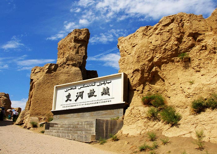
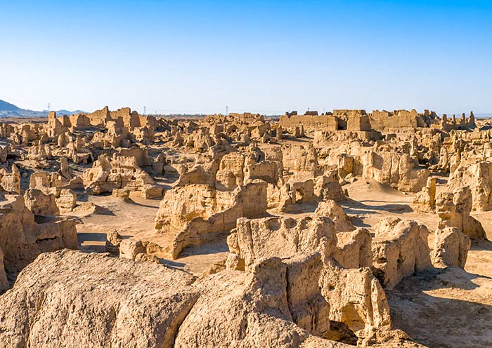
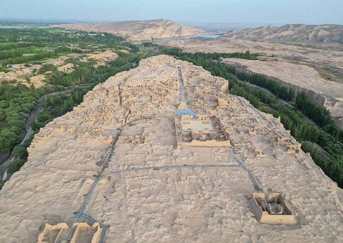
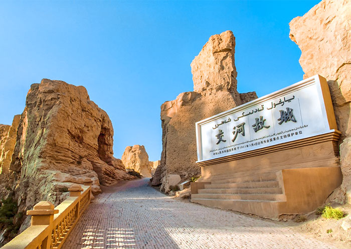
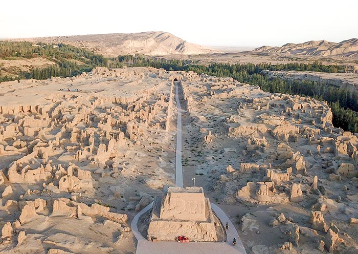
After breakfast, begin your visit to Jiaohe Ancient City (交河故城), one of the best-preserved ruins of ancient cities along the Silk Road and inscribed on the UNESCO World Heritage List as part of the joint application "Silk Roads: the Routes Network of Chang'an-Tianshan Corridor." Jiaohe Ruins offers a profound glimpse into ancient city planning and the historical complexity of the civilizations on the Silk Road.
Nestled between two deep river valleys, Jiaohe, meaning "the confluence of two rivers," is strategically positioned on a large, steep plateau that provides formidable natural defenses. As a key city connecting the Central Plains (中原) and the vast regions of the Western Regions (西域), Jiaohe Ancient City played a vital role in the transportation network of the Silk Road. It witnessed the bustling trade along the Silk Road and the exchange and integration of Eastern and Western cultures.
Unlike many ancient cities, its structures were not built up from the ground but carved down into the existing plateau of loess soil. Walking through the ruins, you can see the remains of government offices, residential houses, Buddhist stupas, and temples. These remnants not only provide important physical evidence for studying the history and culture of the Silk Road but also offer valuable insights into the social, economic, and religious life that shaped this region. Tips: There is no shelter inside the ruin, so be mindful of sun protection.
The History of Jiaohe Ancient City
The Ancient City of Jiaohe witnessed the development of civilization in the Western Region and the Silk Road. Approximately 2,000 years ago, it was established as the capital of the Jushi Kingdom (车师国), one of the 36 kingdoms in the Western Regions (西域三十六国). Following Zhang Qian's pioneering efforts during the Western Han Dynasty to carve a path through the Western Regions, Jiaohe City emerged as a crucial hub on the Silk Road. In 60 BC, the Han Dynasty central government established the Protectorate of the Western Regions (西域都护府) to administer the various states in the region, officially incorporating the Western Regions into the Chinese domain. During the Northern and Southern Dynasties, Jiaohe became a county under the jurisdiction of Gaochang(高昌). The city reached its zenith during the Tang Dynasty with the establishment of the Anxi Protectorate (安西都护府), marking a new era in the governance of the Western Regions. During this period, Jiaohe was a bustling center of international trade and vibrant cultural exchanges among diverse ethnic groups. From the 19th to the 14th century, due to the impact of wars, Jiaohe gradually declined and eventually became a ruin.
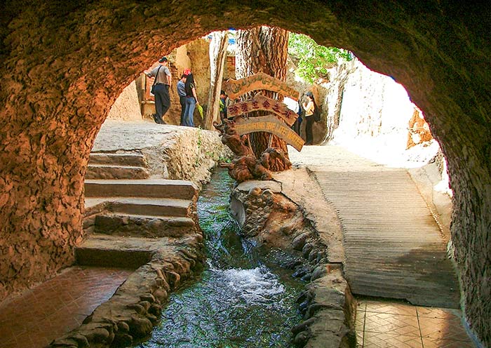
Next, head to the Karez System (坎儿井) to learn about the ancient underground irrigation system a few thousand years ago and how this system has benefitted the people along the desert's edge, transforming barren land into a lush oasis. This traditional engineering marvel is considered one of China’s three great ancient engineering projects, alongside the Great Wall and the Grand Canal. It has been recognized in the 2024 World Irrigation Project Heritage list.
The origin of the Karez Irrigation System
Turpan, in Xinjiang, is one of China's most arid regions, with annual rainfall of only 16 millimeters and evaporation exceeding 3,000 millimeters. These extreme conditions have led to severe surface water scarcity. To improve their survival prospects, people ingeniously utilized the natural slope of mountains to channel underground rainwater, glacial melt, and snowmelt from spring and summer to the surface for irrigation. This method greatly reduced water loss through surface evaporation, meeting the water needs of this arid region. It’s often said, "Without the Karez, there would be no Turpan; without the Karez, there would be no civilization in Turpan." The Karez has turned extremely arid basins into green havens, making Turpan a crucial corridor for East-West exchanges along the Silk Road and a place where diverse cultures converge and coexist.
The Karez system is often referred to as the "Underground Great Wall". In Xinjiang, there are over 1,700 karez wells which, if connected, would stretch over 5,000 kilometers, forming a vast underground river network. It is estimated that the Karez system has a history of over 2,000 years. Imagine centuries ago, without modern measuring tools or mechanical assistance, how ancient people located underground water sources, determined the gradient and direction in complete darkness, and connected such lengthy channels. Today, you have the opportunity to step into the Karez and personally unravel the secrets of this most mysterious hydraulic engineering project, experiencing first-hand how ancient innovation works.
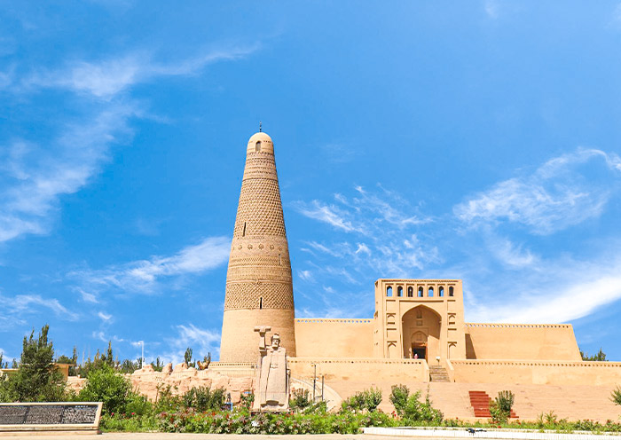
Next, continue your exploration at the Emin Minaret (额敏塔), the tallest Islamic minaret in Xinjiang. Also known as Sugong Ta (苏公塔), this remarkable structure was erected in 1778 by the local ruler Suleiman, in tribute to his father, Emin Khoja, whose considerable efforts helped maintain national unity.
It stands 44 meters (144 feet) tall and is made from sun-dried bricks, which give it a distinct, earthy color. The tower's cylindrical body tapers elegantly as it rises, topped by an ornate, pointed dome. Uyghur artisans crafted up to 15 different types of brick patterns, including waves, diamonds, floral clusters, and crosses, which create endlessly looping designs around the tower. Gazing up from beneath the tower, you can fully appreciate the simplicity and grandeur of these designs. The accompanying mosque is an integral part of the complex, which you can visit as well. Emin Minaret serves not only as a religious structure but also as a cultural icon for the Uyghur people, embodying a unique blend of Islamic and Uyghur architectural traditions.
Afterward, return to Urumqi for an overnight stay.

After breakfast, it is time to end your 5 Days Urumqi Turpan Tour.You will have some free time in Urumqi and explore more at your own pace till your guide escorts you to the airport for your flight to your next destination.
Extension Ideas: If you wish to extend your Xinjiang trip, you can explore other Xinjiang Silk Road Cities such as Kashgar, Kuqa, and Hotan, or venture to North Xinjiang destinations like Kanas, Hemu, and Yining. We'd be happy to assist with these additional arrangements.
Thank you for choosing Asia Odyssey Travel for your Xinjiang Tour, we are always here working for you and hope to seeyou again for your next trip to China/Asia. Safe journey!


Price: What’s Included & What’s Excluded
What's Included:
What's Excluded:
Important Travel Tips for Visiting Xinjiang
Adjust for the Time Difference
Xinjiang follows the unified Beijing Time, which is UTC+08:00. However, due to its geographical location within the UTC+6 time zone, the actual local sunrise and sunset in Xinjiang occur about two hours later than they would according to Beijing Time.
Respect Local Customs and Traditions
Xinjiang is home to various ethnic groups, including Uyghur and Kazakh communities. Many residents practice Islam, so it's important to respect local customs, such as avoiding discussions about pork.
Always seek permission before photographing individuals, especially in rural areas.
Prepare for Climate Variations
Xinjiang experiences significant temperature differences between day and night. Even in summer, evenings can be cool. Pack layers to accommodate these changes.
The region has strong UV radiation. Use sunscreen, wear hats, and consider long-sleeved clothing to protect your skin.
Plan for Long Distances
Xinjiang is vast, and travel between destinations can be lengthy. Plan your itinerary accordingly and be prepared for extended periods on the road.
Security and Documentation
Carry your passport and necessary documents at all times, as security checks are common. Some border areas require special permits.
Altitude Awareness and Health Precautions
Some areas, like the Pamir Plateau, are at high altitudes. Acclimate properly to prevent altitude sickness. Carry a basic first aid kit and any personal medications, as pharmacies may be scarce in remote regions.
Hotel Conditions for Your Xinjiang Tour


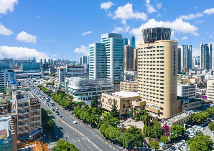
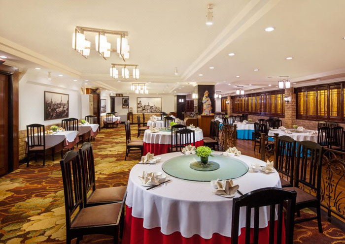
Xinjiang offers a diverse range of accommodations, from luxury 5-star hotels to comfortable 4-star options and basic 3-star lodgings. Whether travelers choose to stay in Urumqi, Turpan, Kashgar, or near Kanas Lake, all our selected hotels are conveniently located near city centers or popular tourist spots.
Major cities like Urumqi and Kashgar boast excellent accommodation options in Xinjiang, with numerous 4- and 5-star hotels offering good amenities and services. In smaller cities like Turpan and Karamay, hotel standards may not match those of larger cities. Star ratings can be inconsistent, so choosing 4- or 5-star hotels is recommended for a comfortable experience. In remote areas such as Kanas and Tashkurgan, accommodations are more basic, often limited to guesthouses or local inns. Facilities may be rudimentary.
Photo Gallery for This Itinerary
Latest Xinjiang Tours Reviews from Our Customers

Teoh Lee Peng
Singapore
Destination(s): Huangshan, Xinjiang, Dunhuang/Gansu
Date of Experience: Aug 28, 2024
Tour Customized by: Runny
You May be Interested in This Tour: Customized Tour

Antonio
Brazil
We travelled through China, from Beijing to the western city of Kashgar, in a trip organized by Odyssey Travel. Everything worked perfectly, from the planning and organization by Triston, our ever-present contact with the company, to each of the local guides in Beijing, Xi’an, Zhangye, Jiayuguan, Dunhuang, and Turpan, which were very well prepared and attentive.
Great trip!
Destination(s): Beijing, Xian, Xinjiang, Dunhuang/Gansu
Date of Experience: Feb 23, 2025
Tour Customized by: Triston
You May be Interested in This Tour: Customized Tour

Rex F
New Zealand
Traveling from Dunhuang to Turpan introduced us to the captivating landscapes of Southern Xinjiang. From vast deserts to ancient cities, each stop held its own mysteries waiting to be discovered. Exploring these remote, culturally rich areas made the trip a true Silk Road adventure - ideal for travelers looking to experience China’s untamed beauty.
Destination(s): Xinjiang
Date of Experience: Jul 23, 2024
Tour Customized by: Claire
You May be Interested in This Tour: 8 Days China Silk Road Tour from Dunhuang to Turpan, Urumqi & Kashgar
Price: request
(Based on a private tour for two people. Price varies depending on program, travel date, number of people.)
Free Enquiry! You don’t need to pay for the reservation.
- United States (+1)
- Australia (+61)
- Singapore (+65)
- Malaysia (+60)
- Philippines (+63)
- Canada (+1)
- Italy (+39)
- Indonesia (+62)
- United Kingdom (+44)
- Spain (+34)
- Mexico (+52)
- Hong Kong (+852)
- Thailand (+66)
- United Arab Emirates (+971)
- New Zealand (+64)
- South Africa (+27)
- Germany (+49)
- Brazil (+55)
- India (+91)
- France (+33)
- Vietnam (+84)
- The Netherlands (+31)
- Saudi Arabia (+966)
- Ireland (+353)
- Argentina (+54)
- Switzerland (+41)
- Romania (+40)
- Pakistan (+92)
- Japan (+81)
- Portugal (+351)
- Bangladesh (+880)
- South Korea (+82)
- Puerto Rico (+1)
- Türkiye (+90)
- China (+86)
- Belgium (+32)
- Qatar (+974)
- Greece (+30)
- Taiwan (+886)
- Austria (+43)
- Poland (+48)
- Israel (+972)
- Chile (+56)
- Sri Lanka (+94)
- Nigeria (+234)
- Peru (+51)
- Colombia (+57)
- Hungary (+36)
- Nepal (+977)
- Denmark (+45)
- Bulgaria (+359)
- Norway (+47)
- Slovenia (+383)
- Sweden (+46)
- Kuwait (+965)
- Costa Rica (+506)
- Ecuador (+593)
- Venezuela (+58)
- Malta (+356)
- Croatia (+385)
- Tunisia (+216)
- Czechia (+420)
- Mongolia (+976)
- Bahrain (+973)
- Mauritius (+230)
- Papua New Guinea (+675)
- Cambodia (+855)
- Dominican Republic (+1)
- Luxembourg (+352)
- Finland (+358)
- Guatemala (+502)
- Myanmar (+95)
- Maldives (+960)
- Slovakia (+421)
- Laos (+856)
- Serbia (+381)
- Brunei (+673)
- Oman (+968)
- Macao (+853)
- Panama (+507)
- Morocco (+212)
- Jordan (+962)
- Georgia (+995)
- Fiji (+679)
- Bolivia (+591)
- Lithuania (+370)
- Bahamas (+1)
- Cyprus (+357)
- Latvia (+371)
- Bhutan (+975)
- Iraq (+964)
- Iran (+98)
- Kenya (+254)
- Jamaica (+1)
- Zimbabwe (+263)
- Azerbaijan (+994)
- Uruguay (+598)
- Estonia (+372)
- Andorra (+376)
- Cameroon (+237)
- Ghana (+233)
- Kazakhstan (+7)
- Nicaragua (+505)
- Egypt (+20)
- Russia (+7)
- Albania (+355)
- Réunion (+262)
- Montenegro (+382)
- Algeria (+213)
- Afghanistan (+93)
- Martinique (+596)
- Uganda (+256)
- Honduras (+504)
- North Macedonia (+389)
- Trinidad and Tobago (+1)
- Suriname (+597)
- Antigua and Barbuda (+1)
- Zambia (+260)
- Ukraine (+380)
- Armenia (+374)
- Barbados (+1)
- Belarus (+375)
- Palestine (+970)
- Lesotho (+266)
- Moldova (+373)
- Ethiopia (+251)
- French Polynesia (+689)
- Gambia (+220)
- Guam (+1)
- Gibraltar (+350)
- Isle of Man (+44)
- New Caledonia (+687)
- El Salvador (+503)
- Comoros (+269)
- Seychelles (+248)
- Chad (+235)
- Samoa (+685)
- Cook Islands (+682)
- Palau (+680)
- Paraguay (+595)
- DR Congo (+243)
- Solomon Islands (+677)
