Urumqi Location Map: Where is Urumqi on a Map
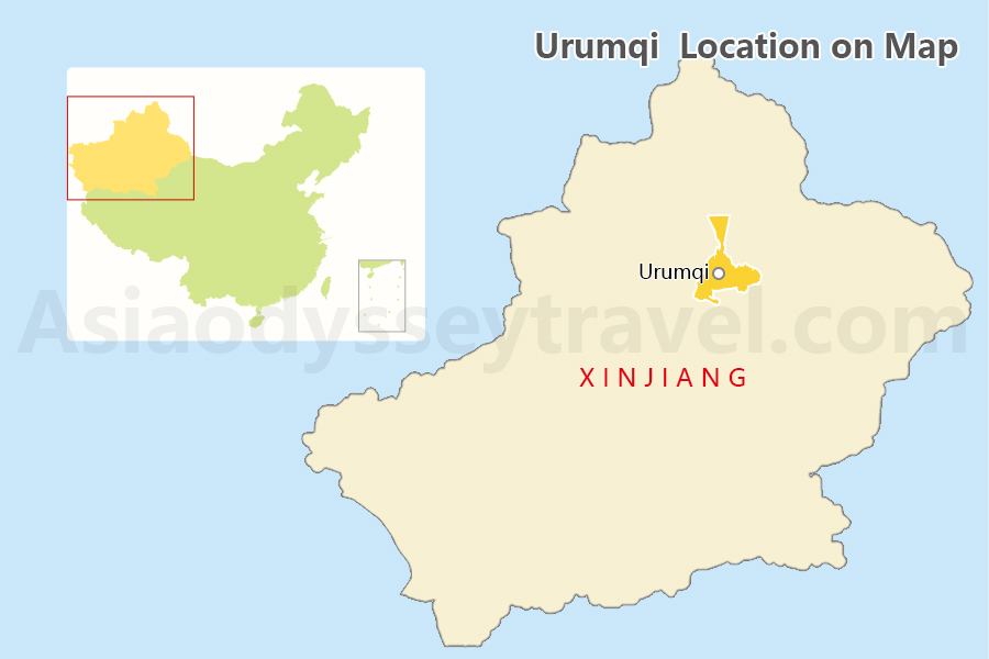
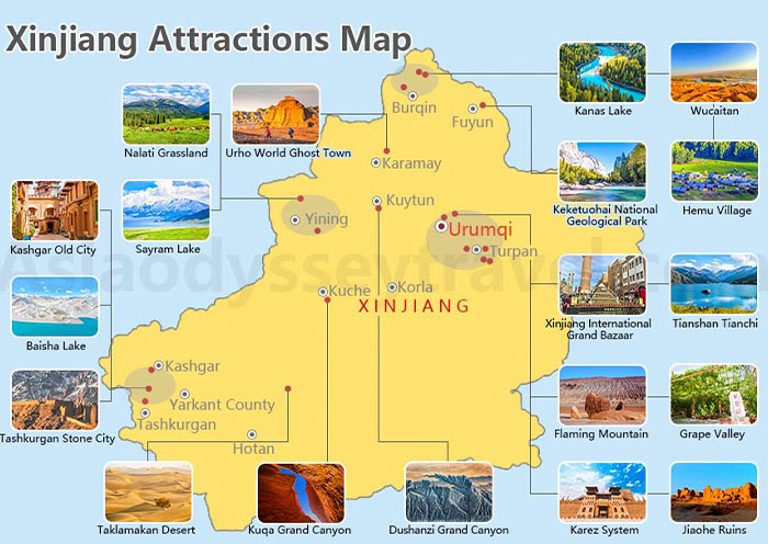
Urumqi is the capital of the Xinjiang Uyghur Autonomous Region in China, located in the northwest part of China. Urumqi lies near the northern foothills of the Tian Shan mountain range, offering stunning views of snow-capped peaks and rugged landscapes.
Urumqi City Map: Metro, Airport, Railway Station
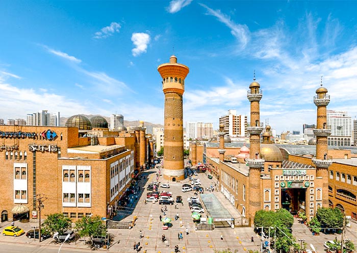
In Urumqi, there is a single subway line running in a north-south direction, starting from Xinjiang Diwopu International Airport and ending at Santunbei, passing through the Xinjiang International Grand Bazaar.
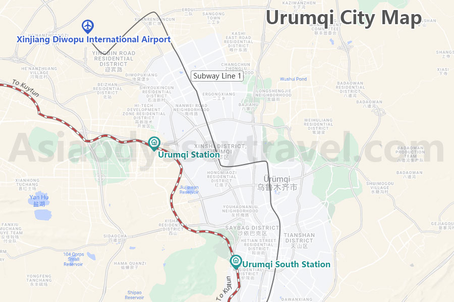
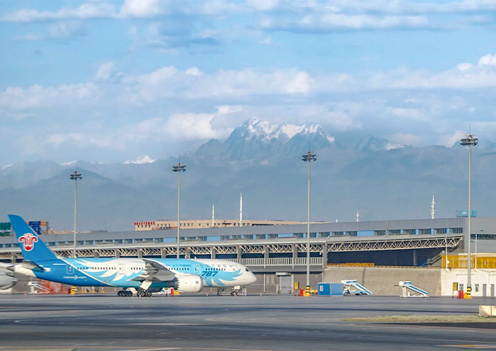
Xinjiang Diwopu International Airport is the only airport within Urumqi, connecting major mainland cities like Chengdu, Beijing, Xi'an, Shanghai, as well as more distant cities within the Xinjiang Autonomous Region such as Kashgar and Yining. You can also take an international flight from oversea to Urumqi.
Urumqi has two train stations, Urumqi Station and Urumqi South Station, with the former having more train services, making it the preferred choice for most tourists.
Urumqi Attractions Map
In Urumqi, there are several attractions that showcase the region's rich cultural heritage, stunning landscapes, and unique blend of ethnic influences. Here are some of the top attractions in Urumqi:
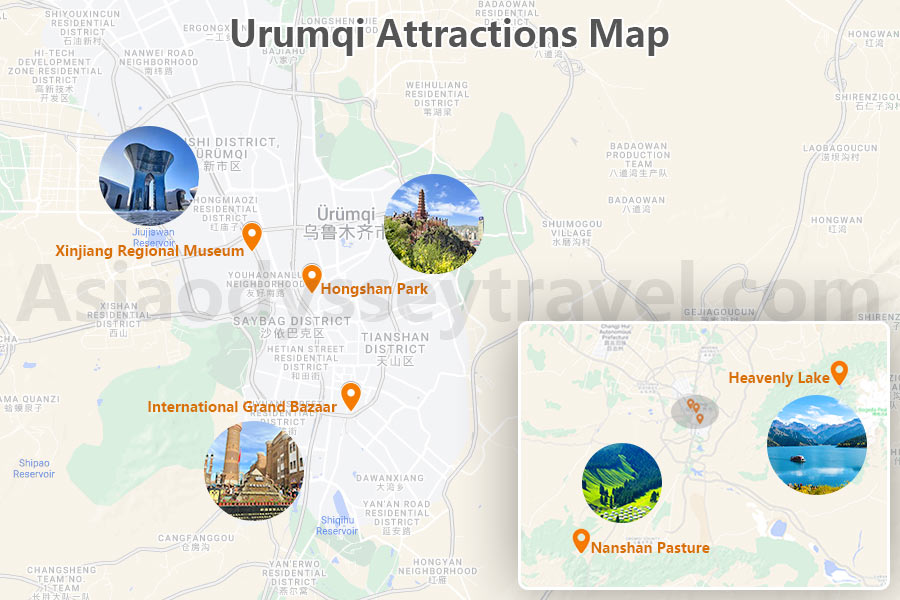
- Xinjiang Regional Museum: Explore exhibits showcasing the history, culture, and diverse ethnic groups of Xinjiang, including artifacts, textiles, and mummies from the region.
- International Grand Bazaar: Immerse yourself in the bustling atmosphere of this traditional market, where you can shop for local crafts, spices, dried fruits, and Uyghur souvenirs.
- Hongshan Park (Red Hill Park): Enjoy panoramic views of Urumqi from Hongshan Park, a scenic area with gardens, pavilions, and a cable car ride to the mountaintop.
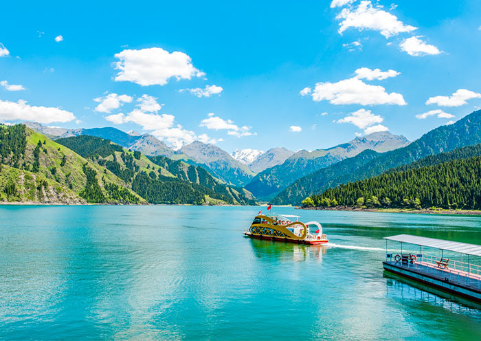
- Heavenly Lake (Tianchi): Visit this picturesque alpine lake located in the Tianshan Mountains, surrounded by lush forests and snow-capped peaks, offering hiking and boating opportunities.
- Nanshan Pasture: Experience the nomadic lifestyle at Nanshan Pasture, where you can see yurts, traditional performances, and enjoy horseback riding in a beautiful natural setting.
Urumqi Transportation Map
Urumqi serves as a crucial transportation hub in western China, with an international airport, railway connections, and highways linking it to other parts of Xinjiang and China.
Urumqi to Turpan Map
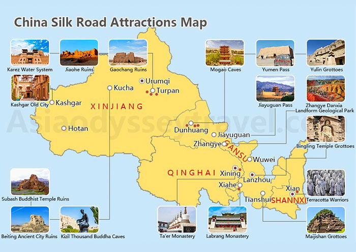
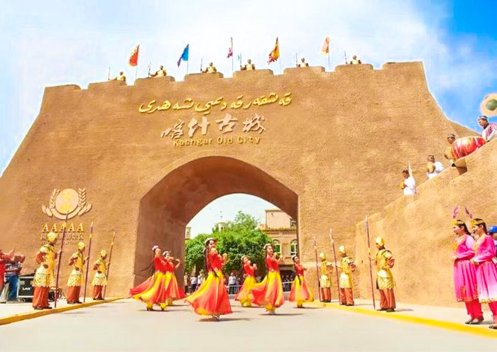
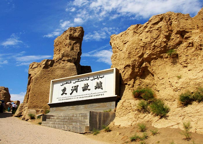
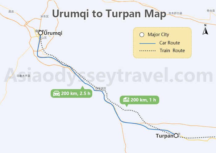
Traveling from Urumqi to Turpan, approximately 200 kilometers away, can be conveniently done by either car or high-speed train. The journey offers a mix of desert landscapes and historical sites, with attractions like the Flaming Mountains and the ancient city of Jiaohe along the way.
Urumqi to Kashgar Map
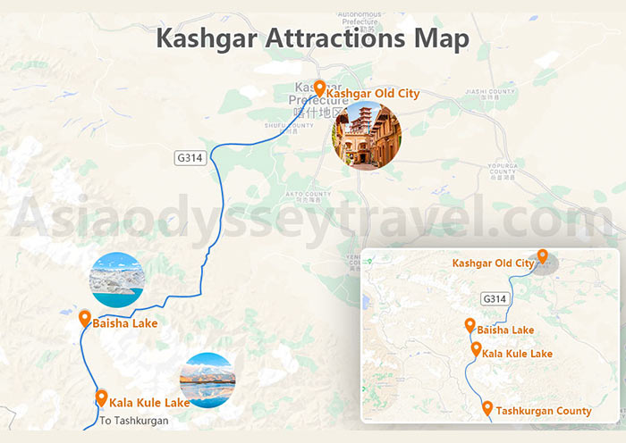
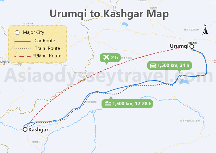
For the longer journey from Urumqi to Kashgar, spanning about 1,500 kilometers, travelers have multiple transportation options such as car, regular train, or air travel. Each mode of transport provides a unique perspective of the diverse landscapes of Xinjiang, from the vast deserts to the towering mountains, and the rich cultural tapestry of the region.
Urumqi to Kanas Lake Map
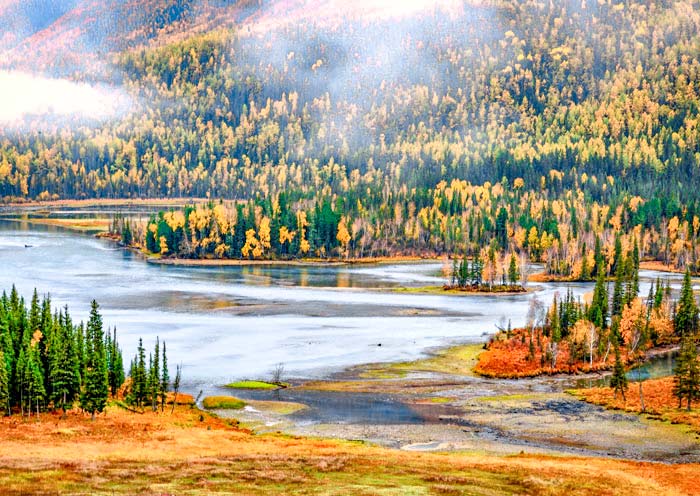
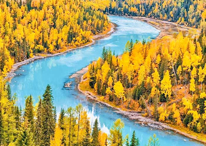
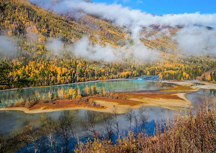
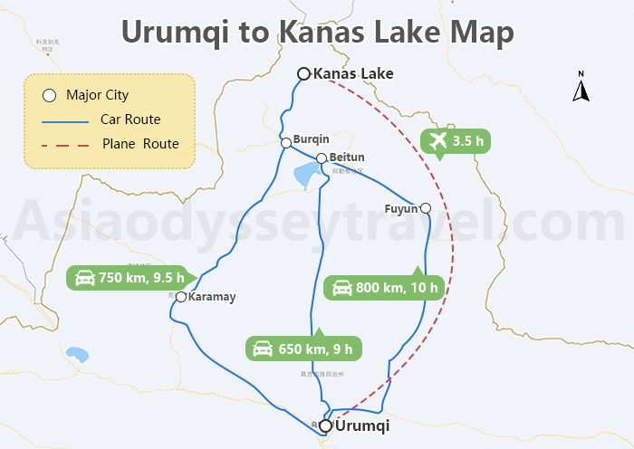
Covering a distance of around 750 kilometers from Urumqi to Kanas Lake, travelers can opt for a road trip by car or take a seasonal flight to reach this stunning alpine lake in northern Xinjiang. The journey offers breathtaking views of the Altai Mountains and a chance to experience the pristine beauty of Kanas Lake and its surrounding forests.
Beijing to Urumqi
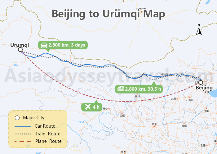
Traveling from Beijing to Urumqi, a distance of approximately 2800 kilometers, offers various transportation options including flights, trains, or long-distance overland routes. While a flight provides the quickest journey, both train and overland routes offer a chance to witness the diverse landscapes of China as you make your way to the vibrant city of Urumqi in Xinjiang.
Shanghai to Urumqi
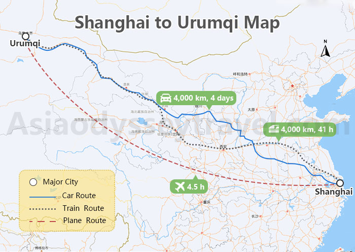
From Shanghai to Urumqi, covering a distance of about 4000 kilometers, the most common modes of transportation are flights or long-distance trains. The journey presents an opportunity to traverse vast distances across China, from the bustling metropolis of Shanghai to the culturally rich region of Xinjiang, with its unique blend of Central Asian influences.
Xian to Urumqi
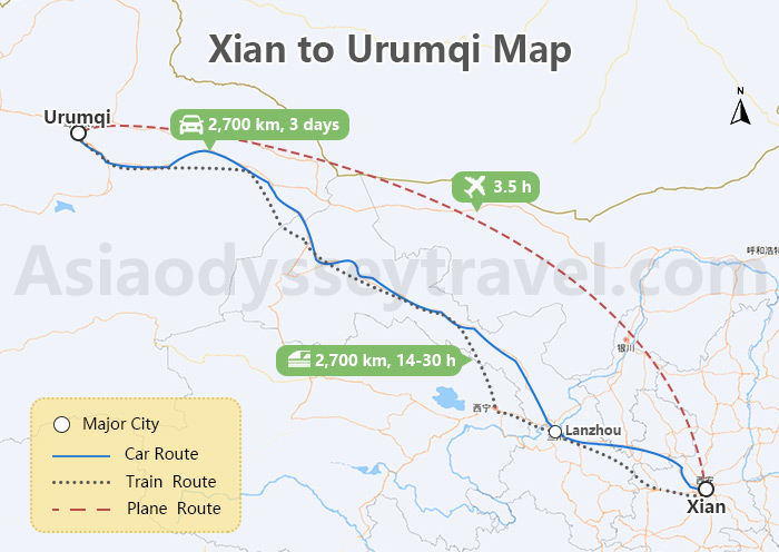
Traversing the 2700-kilometer distance from Xian to Urumqi can be accomplished by taking a flight, high-speed train, or opting for a long-distance overland journey. Each mode of transport offers a different perspective of China's varied landscapes and cultural transitions, culminating in the exploration of Urumqi's distinct charm at the heart of the Silk Road.
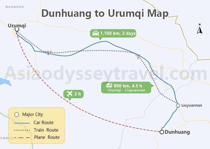
Dunhuang to Urumqi
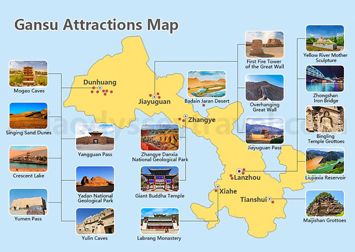
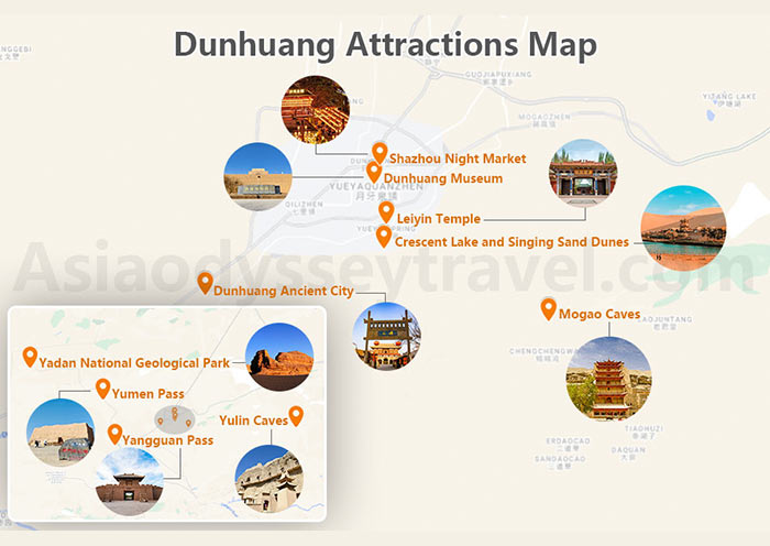
For the journey from Dunhuang to Urumqi, which spans around 1100 kilometers, travelers have the choice of flying, taking a high-speed train, or embarking on a long-distance overland adventure. This route allows for a transition from the historical and cultural richness of Dunhuang to the scenic beauty and cultural diversity of Urumqi in Xinjiang, providing a glimpse into the vastness and contrasts of China's western regions.
Urumqi Travel Map: Urumqi Itinerary with Map
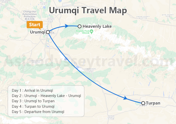
Day 1: Arrival in Urumqi
Arrive in Urumqi and be greeted at the airport for transfer to your accommodation to complete check-in procedures.
Day 2: Urumqi - Heavenly Lake - Urumqi
Explore the stunning Heavenly Lake in the Tianshan Mountains and visit the Xinjiang Regional Museum to delve into the history and culture of the region.
Day 3: Urumqi to Turpan
Journey to Turpan, passing by the Flaming Mountains, and visit the picturesque Tuyugou Village and the Bezeklik Thousand Buddha Caves.
Day 4: Turpan to Urumqi
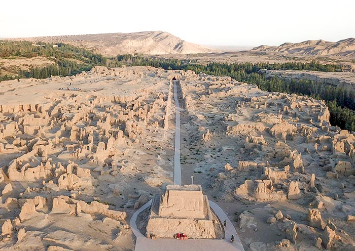
Visit the ancient ruins of Jiaohe at the Jiaohe Ancient City site, explore the unique Karez Water System, and marvel at the architectural beauty of the Emin Minaret.
Day 5: Departure from Urumqi
Check out from your hotel in Urumqi and transfer to the airport for your departure from this vibrant city in Xinjiang.
Travel with Asia Odyssey Travel, Culture & Nature Xinjiang Tour
First-time visitor or not, Xinjiang is Not What You Think. It's More Than What You Imagine!
Looking for natural grandeur? Experience the the sunrise at pristine Kanas Lake, the sky-touching Naraty Grassland, the boundless Taklamakan Desert along the acient Xinjiang Silk Road.
Looking to broaden your horizons? Discover exquisite Uyghur crafts at the bazaars at Kashgar, the nomadic dances of Tajiks on the Pamir Plateau at Tashkurgan, and the finest vineyards at Grape Valley at Turpan. You can even visit the oldest Buddha Grottoes in China!
Your Xinjiang Trip will be an eye-opening adventure and a soul-touching journey!
Asia Odyssey Travel: Your Best Xinjiang Guide
- Genuine Service: Not just an agency—we are your travel companions.
- Exclusive Access: Secure your tickets and accommodations even in high season.
- Authentic Experience: Best local guides with cultural insights.
- Travel Made Easy: Flights, hotels, activities—all taken care of!
- Skip the Tourist Routine: Avoid all tourist traps and travel down to earth
- 24/7 Support: Always on-line for your peace of mind
Asia Odyssey Travel, leading your China Adventure Since 2010. What's your travel idea? Let's talk!
